A new study by researchers at the Department of Sociology and the Leverhulme Centre for Demographic Science (LCDS) has developed a way to track population movement in war zones.
Published in Population and Development Review and written by Edith Darin, Professor Ridhi Kashyap and Dr Douglas Leasure, the research measures forced displacement during the first six months of the Israel-Hamas war, using high-frequency digital data.
The study combines daily data from Facebook's marketing API with demographic estimates, satellite imagery, conflict event data, and evacuation orders to track how populations moved across the Gaza Strip between October 2023 and May 2024.
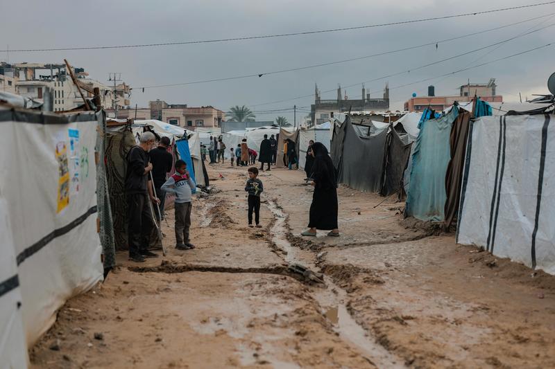
The researchers estimate that at the peak of displacement, up to 70% of Gaza's population had been displaced internally, making it proportionally one of the largest and fastest displacement crises compared to the size of the population, recorded in recent history.
By applying the same methodology across countries, the researchers compared displacement dynamics in Gaza with those in Ukraine, Egypt, and Jordan. While the war in Ukraine displaced larger numbers in absolute terms, displacement in Gaza was dramatically more intense relative to population size: three times larger, eight times faster, and five times more sustained than displacement observed during Russia's full-scale invasion of Ukraine.
The study also revealed important gendered patterns in displacement. During the early phase of the war, women were more likely to move before men, when safer destinations could still be identified.
As the conflict intensified and "safe zones" disappeared, these patterns shifted, highlighting how the calculus of flight changes as options narrow and uncertainty grows.
The research traces how population movement evolved in distinct phases: an initial anticipatory response in the first weeks of war, as people moved ahead of advancing danger; a reactive phase as violence escalated; and a gradual tapering off as uncertainty deepened and displacement became the new normal.
This granular temporal picture, near-impossible to capture with traditional data systems, is precisely what the digital approach makes visible.
Lead author Edith Darin said:
In conflicts and humanitarian crises, population movements can change dramatically from day to day, but traditional data systems are often unable to keep pace.
Our work shows how digital trace data can help provide timely demographic insights even during active conflict. By combining social media data with satellite imagery and conflict event data, we can better understand not only how many people are displaced, but also how displacement evolves through time, space, and across different population groups.
The paper’s findings are important as population displacement during armed conflicts can pose major challenges to the timely and effective delivery of humanitarian assistance.